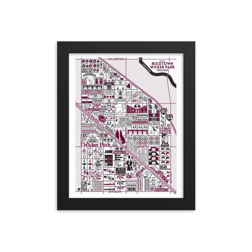
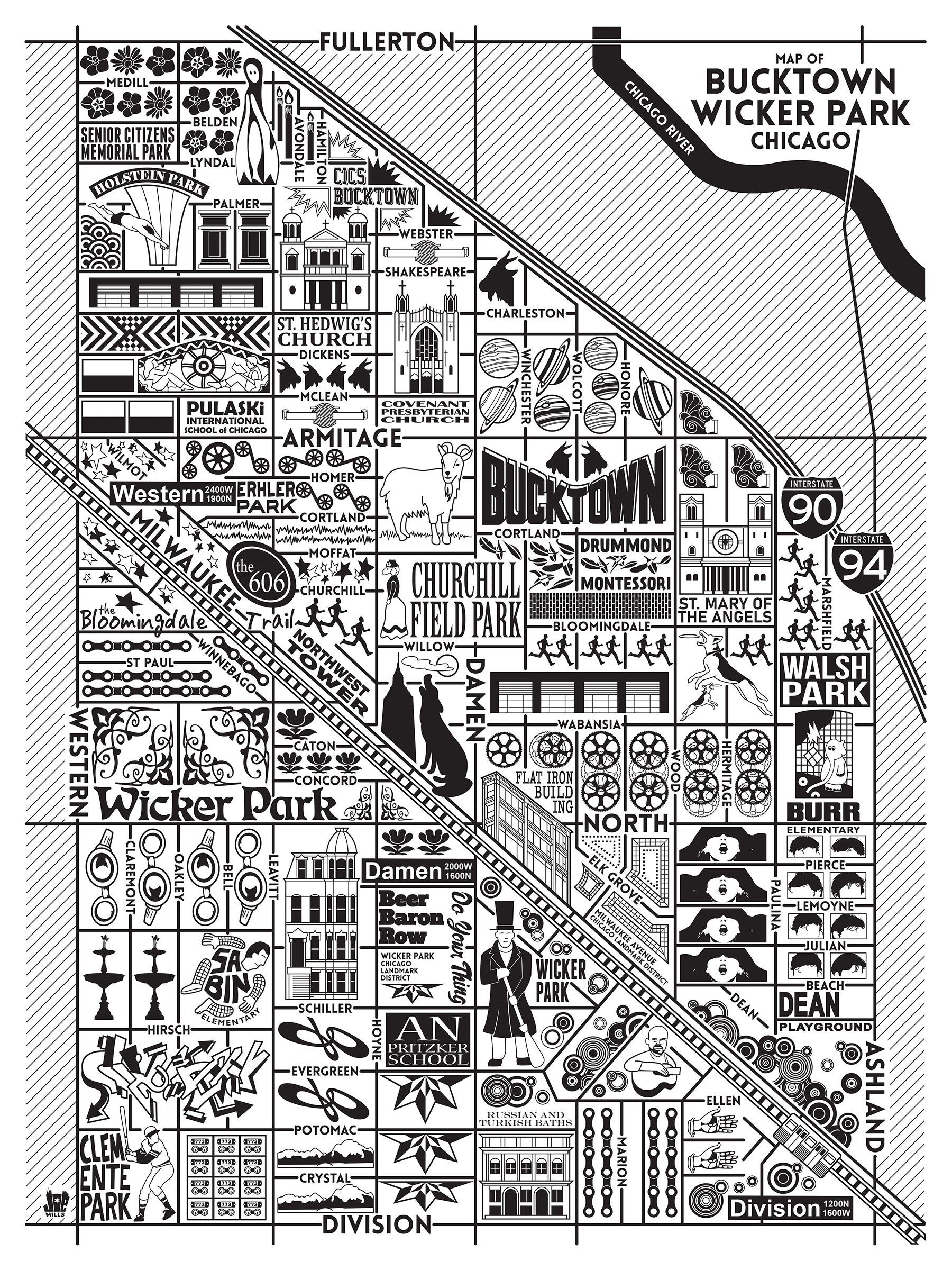
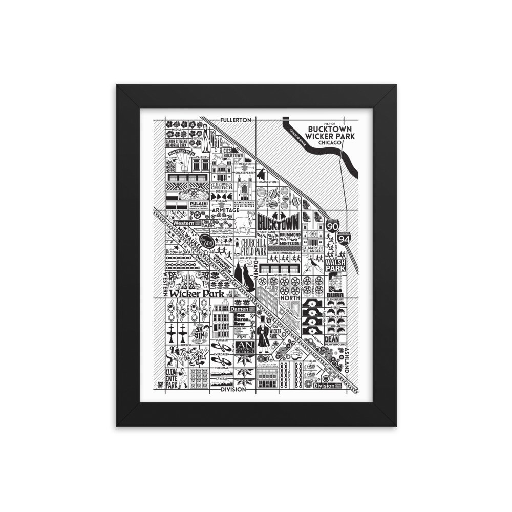
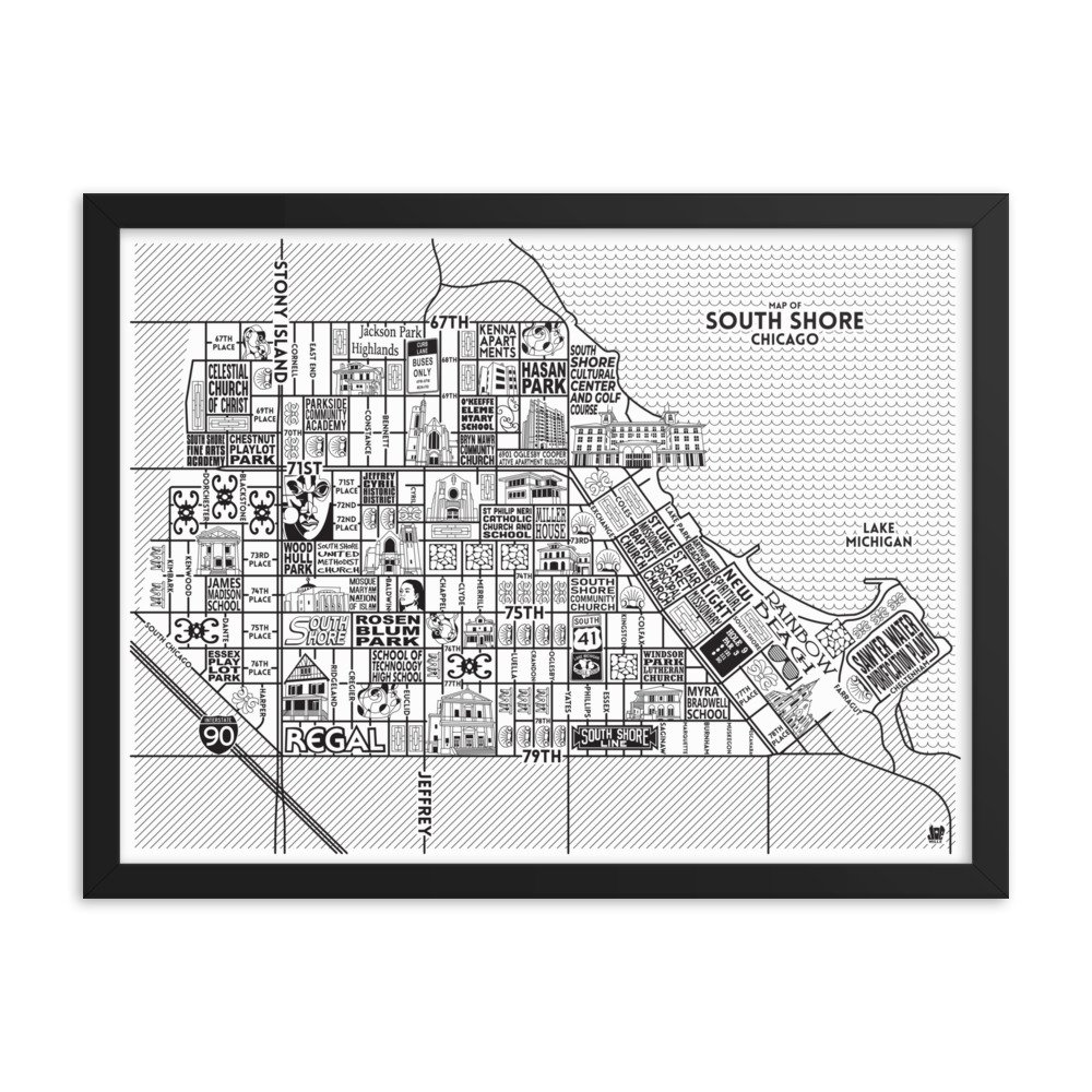
'Portage Park' by Joe Mills
Updated in 2024!
Chicagoans feel very strongly about their neighborhoods. Every neighborhood in Chicago has a unique history. The Portage Park Map is the twenty-sixth in a series of illustrations that will chronicle the major landmarks, parks, streets, buildings, structures, history and events of each neighborhood.
This illustration is a museum-quality poster made on thick and durable matte paper. Each poster is giclée-printed on archival, acid-free paper that yields brilliant prints to brighten up any room.
This product is printed on demand and fulfilled by Printful.
8” x 10” without frame: $30
8” x 10” with frame: $70
18” x 24” without frame: $40
18” x 24” with frame: $105
All sales are final. This item does not ship internationally.
Frame Details
Alder, semi-hardwood .75″ (1.9 cm) thick frame from renewable forests
Lightweight
Acrylite front protector
Hanging hardware included
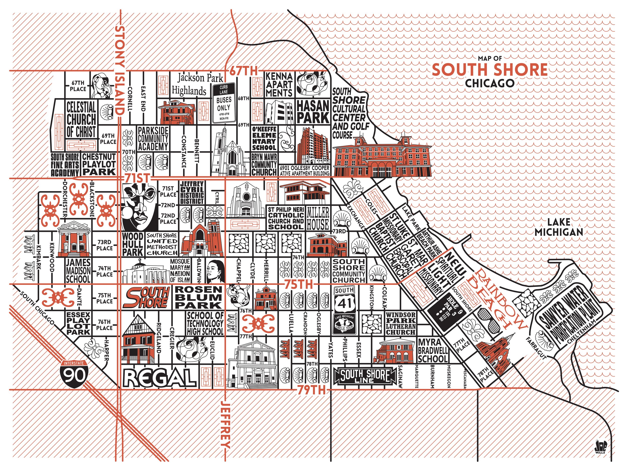
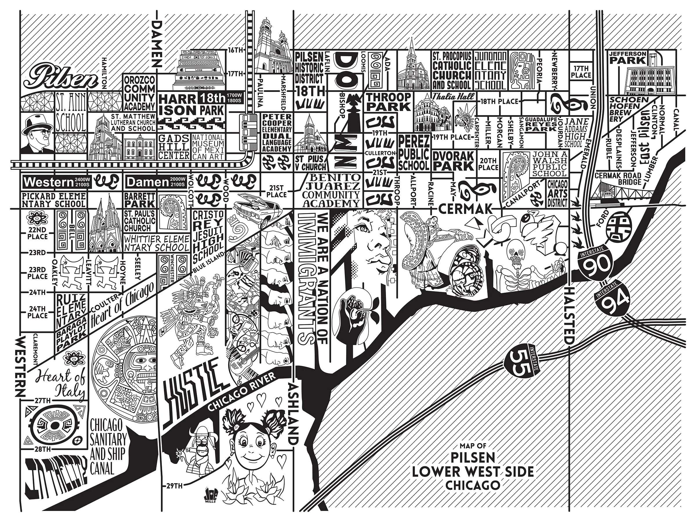
 Image 1 of 10
 Image 2 of 10
 Image 3 of 10
 Image 4 of 10
 Image 5 of 10
 Image 6 of 10
 Image 7 of 10
 Image 8 of 10
 Image 9 of 10
 Image 10 of 10